

GIS analytics tells you about the land. Precision agronomy goes one step further and applies that terrain intelligence directly to what’s growing — or what could grow — on it, zone by zone and tree by tree.
Crop Siting: Matching Terrain to Crop
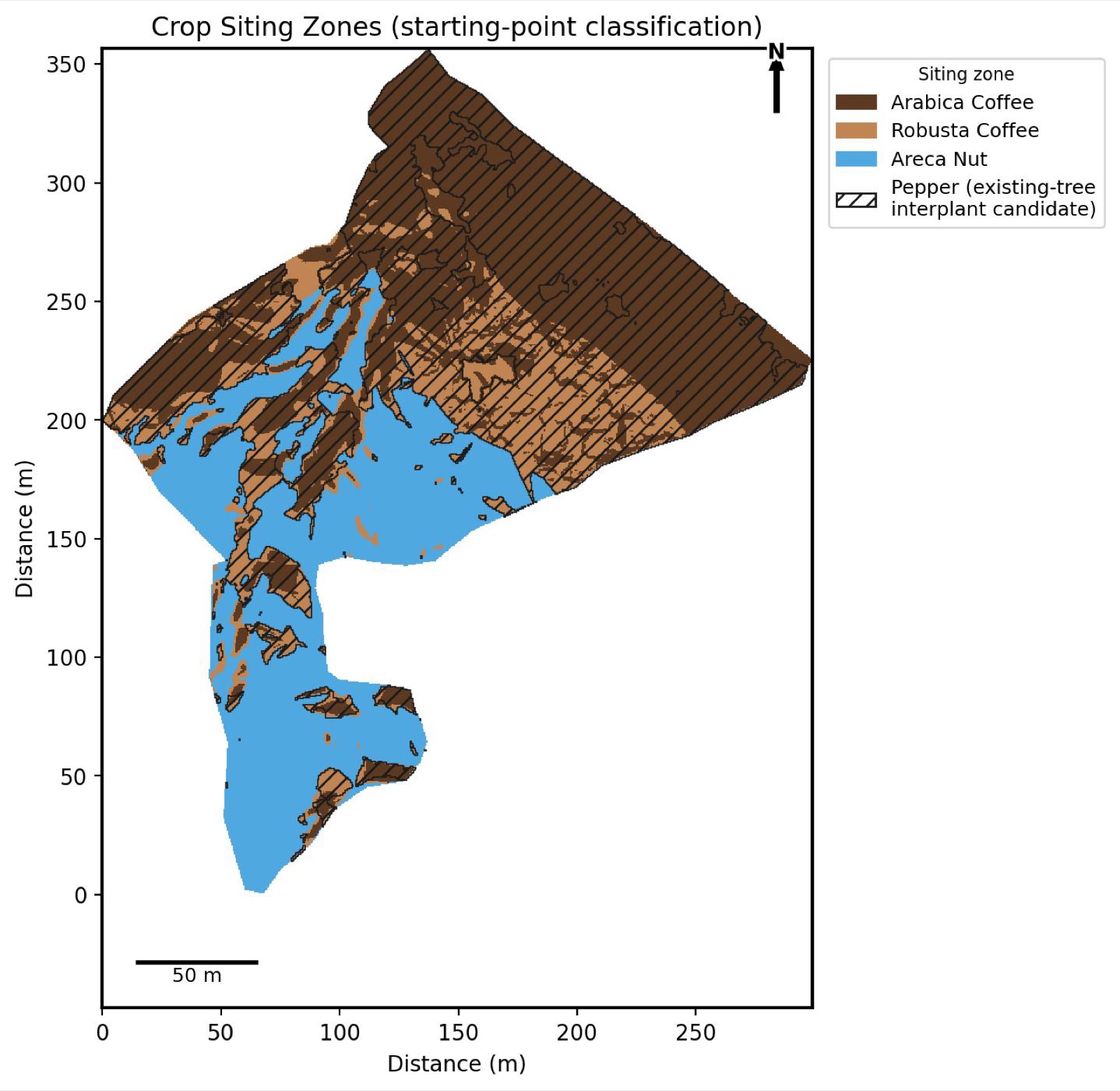
Different crops want different conditions. Arabica coffee generally prefers higher elevation and cooler, shadier zones; Robusta tolerates warmer, lower ground; areca nut needs its own combination of soil moisture and sun exposure. Rather than relying on where things happen to already be planted, crop siting analysis layers slope, elevation, and sun exposure against known cultivation requirements, and classifies the estate into zones — including flagging existing-canopy areas that are strong candidates for a pepper interplant, since pepper climbs on established shade trees rather than needing its own cleared ground.
The output is a map, not just an opinion: a defensible starting point for planting decisions, replanting priorities, or evaluating whether an underperforming zone is actually the wrong crop for that terrain.
Individual Tree & Plant Detection
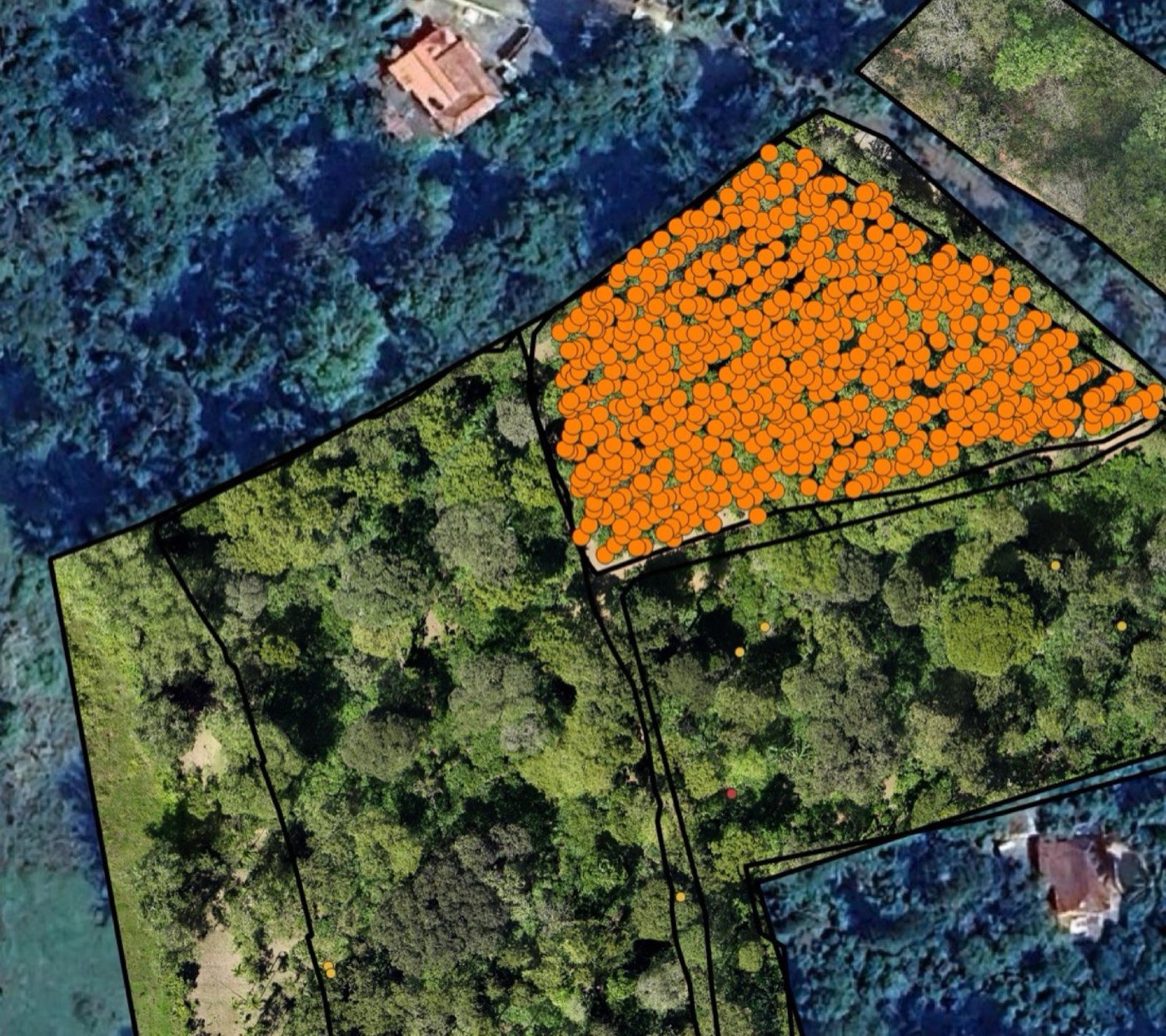
Separately, individual trees and plants can be detected and counted directly from the orthomosaic — no field walk, no manual tally. Each detected plant becomes a point with a location, giving you an exact stand count rather than an estimate extrapolated from a sample block.
Plant-Type Classification
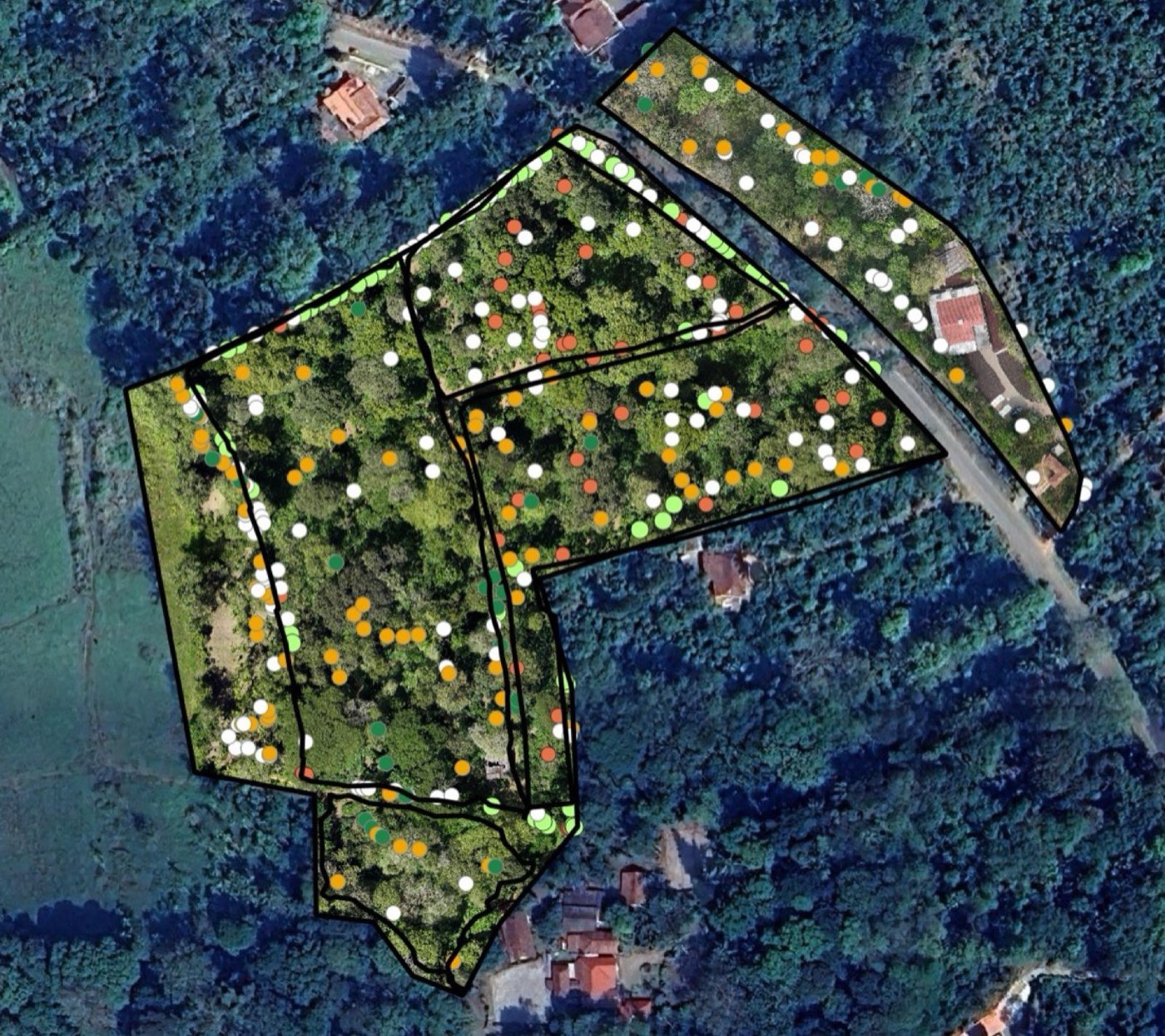
Where multiple crops or varieties are interplanted — common on older, mixed estates — classification can distinguish between them directly from imagery, block by block. Combined with the detection count above, this gives a variety-level breakdown of exactly what’s planted where, without relying on estate records that may not reflect what’s actually in the ground after years of replanting and interplanting.
Why This Matters Beyond the Map
Individually, a crop-siting map or a tree count is a nice-to-have. Together, layered on the same terrain model as everything else in a survey, they start to answer a harder question: not just “how is this zone performing,” but “should this zone even be growing what it’s currently growing.” That’s the kind of analysis that’s normally only available to estates large enough to run their own agronomy team — Future Thota makes it a standard output of a drone survey.
This is one of the newer additions to our GIS Analytics & Precision Agronomy service — get in touch if you’d like to see what it looks like on your own estate.