RTK Drone Survey India: NTRIP Subscription Guide
introduction
If you own a drone with an RTK module and are looking to achieve centimetre-level positioning accuracy, you’ll need an NTRIP subscription or a physical base station unit.
This guide explains how to set up an NTRIP connection for RTK drone mapping in India, helping you unlock the full precision capabilities of your drone.
While we focus on drones using RTK, the principles discussed here apply to any RTK-capable hardware, including GPS rovers and surveying instruments.
Why Use RTK for Drone Surveys?
If you’re familiar with GPS, think of RTK (Real-Time Kinematic positioning) as GPS on steroids.
-
Standard GPS: Positioning accuracy within meters
-
RTK GPS: Accuracy within centimeters
To use RTK effectively, you need three components:
-
A drone or device equipped with GPS and RTK modules
-
Access to a base station (either your own or a subscription service)
-
An NTRIP subscription to receive real-time correction data over the internet
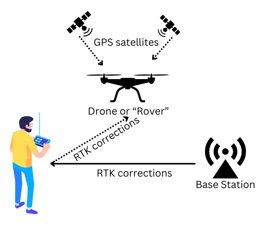
What is a Base Station in RTK?
The RTK system consists of two parts:
-
Base Station: Sends real-time corrections to account for GPS signal distortions.
-
Rover: The moving device (your drone) that receives corrections for precise positioning.
You have two options for a base station:
-
Physical Base Station: Set up your own unit at the worksite (expensive and cumbersome).
-
Subscription-Based Service (Recommended): Use an internet-based correction service, avoiding the need for physical hardware.
For most drone RTK mapping operations in India, using a subscription-based NTRIP service is faster, easier, and more cost-effective.
How RTK Corrections Work
GPS signals from satellites are affected by environmental factors like air particles, leading to minor errors.
RTK systems send correction data in real time to your drone, adjusting these errors and achieving high precision.
For drones like the DJI Mavic 3 Enterprise or Phantom 4 RTK:
-
The remote controller (RC) connects to the internet via mobile hotspot or Wi-Fi.
-
The RTK corrections are then transmitted from the RC to the drone automatically.
NTRIP Subscription in India – Survey of India CORS Network
In India, the Survey of India operates a growing network of CORS (Continuously Operating Reference Stations) across most states, offering NTRIP subscriptions.
👉 Check CORS Coverage: Survey of India CORS Services
In states like Andhra Pradesh, access is currently managed at the state level but is expected to integrate with the national Survey of India network soon.
Step-by-Step Setup for Survey of India NTRIP Service
Here’s a simplified path to get your RTK drone operational:
-
Register
Sign up at: Survey of India CORS Registration -
Subscribe and Pay
-
Follow the SOP listed here: Survey of India Subscription SOP
-
Payments are made through Bharatkosh portal.
-
Start with a 1-month basic plan to test connectivity in your local area.
-
-
Get Connection Settings
-
General settings are available here: CORS Connection Settings
-
Note your username and password — you’ll need these to configure your drone.
-
Configuring RTK Settings on DJI Drones
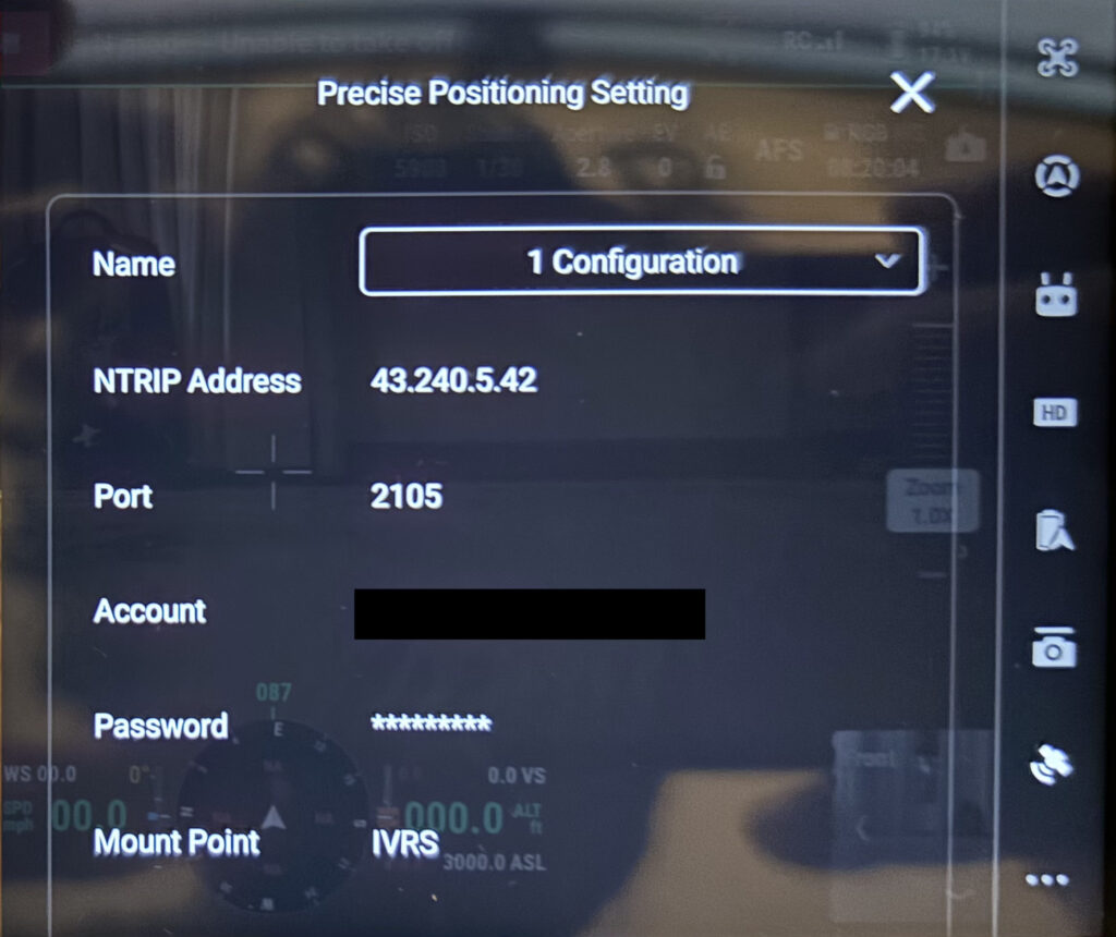
If you’re using a DJI drone such as the Mavic 3 Enterprise:
-
Go to the RTK settings menu on your DJI RC.
-
Choose Custom Network instead of D-RTK 2 Base Station.
-
Enter the following:
-
NTRIP Address and Port (provided by Survey of India).
-
Your username and password from your subscription.
-
-
Mount Point: Select “IVRS” (recommended for DJI drones).
Tip: Ensure your drone’s remote controller maintains a strong internet connection via mobile hotspot or field Wi-Fi.
Conclusion
RTK drone mapping in India is now easier than ever, thanks to the Survey of India’s CORS network.
By setting up an NTRIP subscription, you can achieve hassle-free, centimetre-level accurate positioning for your drone surveys, agricultural mapping, and construction site monitoring.
At Future Thota, we leverage RTK drone surveys to deliver high-precision agricultural and plantation mapping solutions.
If you need help setting up RTK operations or require drone-based mapping services for agriculture, forestry, or land surveys, contact us !