

We believe in flying drones automatically wherever possible — manual flight introduces inconsistency between sessions, and risk that a fixed flight plan avoids. That belief is why every mapping mission we run starts with the same first step: a boundary, defined precisely, before the drone ever leaves the ground. In Field, our browser tool at tools.futurethota.com, puts that same first step in front of anyone who wants it — no GIS software, no install.
Step 1: Draw or Import a Boundary
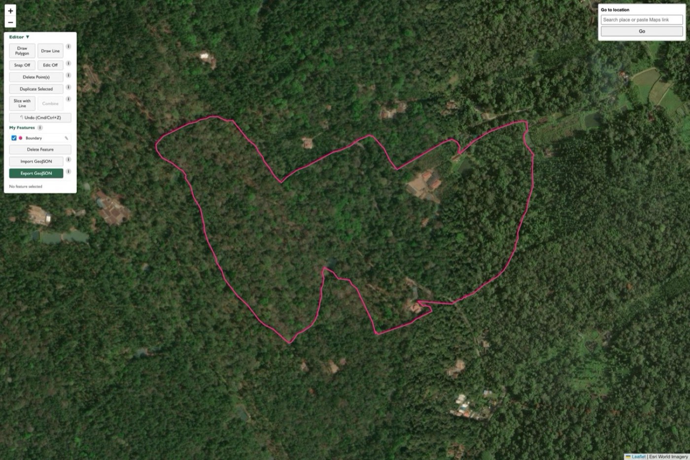
Draw a boundary directly on a live satellite basemap — click to place vertices, drag to adjust, snap and undo as you refine the shape. Already have a boundary from a walked GPS track or another source? Import it directly as GeoJSON rather than redrawing from scratch.
The boundary is the single source of truth for everything downstream: it’s what converts into a flight-mappable file for an enterprise-grade mapping drone’s own flight-planning software, and it’s what the automated flight path below is generated from.
Step 2: Generate an Automated Video Flight Path
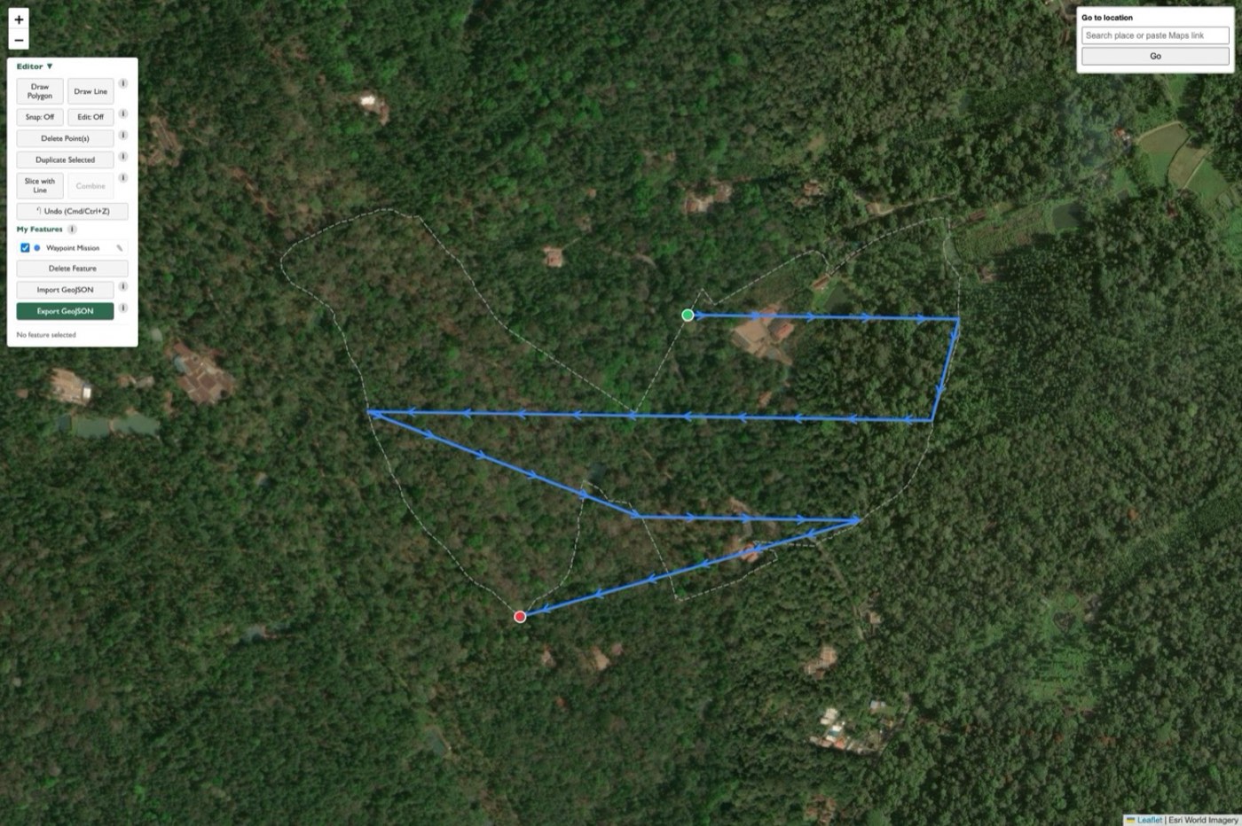
From the same boundary, the tool generates a lawnmower-pattern automated video flight path — flown at a smooth, constant speed and gimbal angle, covering the full site systematically rather than relying on a manual pass. Because it’s generated from the boundary rather than flown freehand, it’s precisely repeatable: fly the exact same route again next season, and you get a directly comparable before-and-after record of how the landscape has changed.
Step 3: Export and Fly
Both the boundary and the flight path export as ready-to-use files — a KMZ for mission planning software, or GeoJSON for any GIS tool. No manual re-entry of coordinates, no redrawing the same shape in a different piece of software for each stage of the workflow.
After the Flight: An Interactive Web Viewer
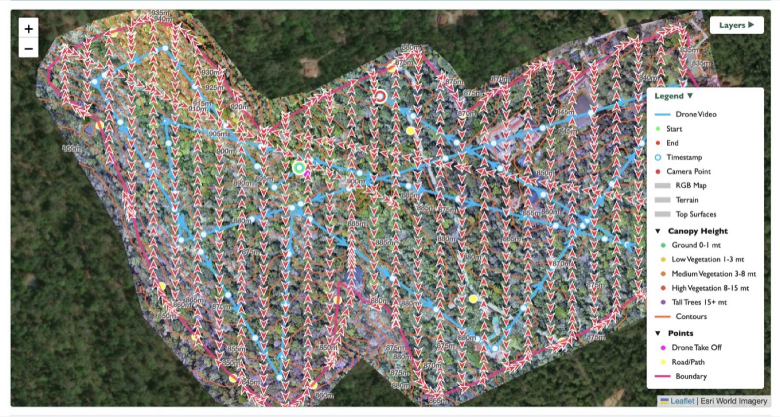
Planning the mission is only the browser tool’s first job. Every completed survey also ships with its own interactive web viewer — flight paths, terrain layers, canopy height, and contours, all toggleable on a live map, with no desktop GIS software required to explore your own data. It’s the same browser-first philosophy applied to the other end of the workflow: after the drone lands, not just before it takes off.
Not Just for Drone Mapping
The same polygon editor works as a general-purpose spatial tool independent of whether a drone survey follows at all — property boundary demarcation, asset and infrastructure mapping, or agri-input planning all use the identical draw-and-export workflow.
It’s the same tool we use to plan our own survey missions, made available to anyone who wants it. Try In Field now, or read more about field planning and precision GPS if you’d rather have us fly the survey for you.