If you have a drone with an RTK module, and are looking for an NTRIP subscription to utilise the centimetre level positioning accuracy, this blog explains the setup for this service in India. Although we talk about drones using RTK, the same principles can be applied to other RTK capable hardware.
This article assumes you know a bit about RTK and why you would need to use it. In short, RTK is like GPS on steroids. Where GPS accuracy is in metres, RTK is in centimeters. To use RTK you need the following:
- Drone (or some device) with both GPS and an RTK module
- An RTK subscription (NTRIP) or RTK base station
Base station - Physical or Subscription
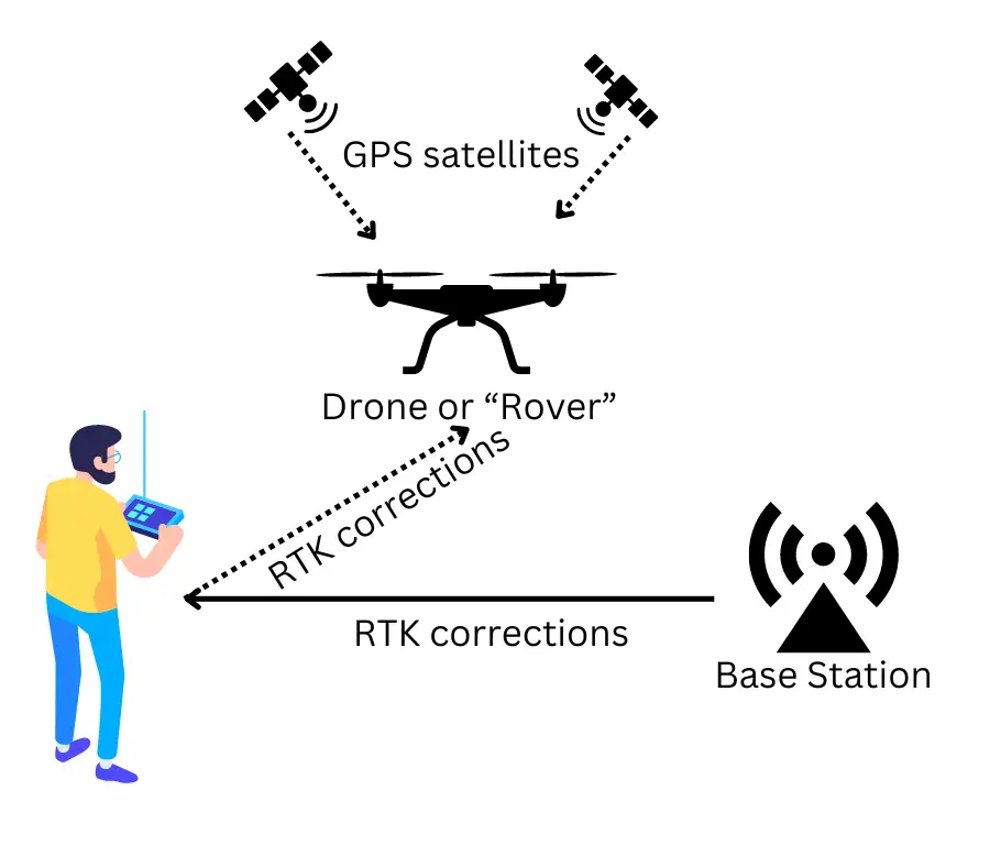
The RTK system consists of a “base station” and a “rover”. The rover is the device which requires the precise positioning co-ordinates (like a drone), and the base station sends the GPS co-ordinate corrections. The base station can either be a physical device setup by you on your work site, or one setup by a service provider several kilometres away. With the latter, the corrections are received over an internet connection using a subscription, and you do not need to purchase and carry around an expensive physical base station. We recommend the subscription based services to start.
The “corrections” simply update the GPS values obtained from the GPS sensor, to account for distortions caused by errors in transmission of the signal from the satellites. These transmission errors are typically caused due to dispersion from air particles and other environmental factors.
In a drone, the RTK “corrections” are typically received on the remote controller (RC), and then transmitted to the drone. This means the RC should be connected to a Wifi network. If you are flying in an open area, you can share your mobile internet connection by setting up a hotspot.
Survey of India
In India, most states have an RTK base station network (Continuously Operating Reference Stations), setup by the Survey of India. You can check if your region is covered here and if yes, go ahead and sign up. At the time of writing this, most states are covered by the Survey of India, and one has to sign up using the link above. In some states like Andhra Pradesh, the access to CORS network is managed by the state government at this point in time and may be integrated with Survey of India soon.
Ideally, you can just follow the instructions and SOPs on the Survey of India CORS website. There is no need to be intimidated by the abundance of information provided. Just follow these steps:
- First register: https://cors.surveyofindia.gov.in/cors-services.php
- Then subscribe and pay for the service on bharath kosh: https://cors.surveyofindia.gov.in/policies/subscription_sop.pdf. Note that this may take some time to go through all the steps and complete payment. I recommend trying it out with the basic 1 month plan first to see if it works well at your specific location.
- The general connection settings can be found here: https://cors.surveyofindia.gov.in/connection-settings.php
- After subscription, please note your “username” and “password” which will be required to configure the connection on your drone.
RTK settings on the drone

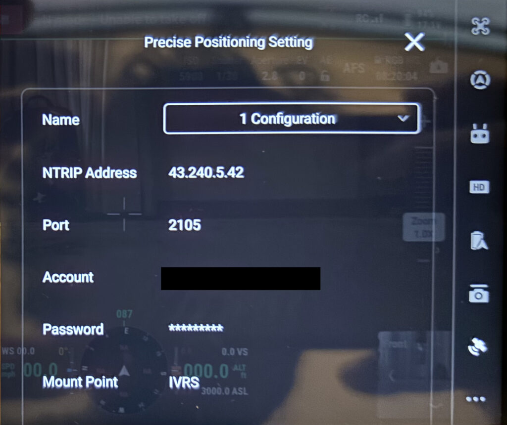
Identify where to enter the RTK configuration for the drone. For DJI drones setup is on the RC.
- Choose custom network (instead of base station)
- The NTRIP address and Port can be found in the general connection settings.
- Enter your username for account, and the password.
- The Survey of India connection page suggests some mount point names, but only “IVRS” seems to work on the DJI drone.
Conclusion
As seen above, NTRIP based subscription services for RTK in India is very much alive and kicking. Thanks to the Survey of India for setting up this infrastructure, allowing us to access hassle free centimetre level accurate global positioning systems, for precise drone mapping operations. Hopefully this guide was useful in helping you avail this service.
Please get in touch with us using the contact form on the Future Thota website for agri and vegetation mapping services.


