

Drone Mapping · GIS & Data Tools · Sensors & GPS
Ground truth for agriculture and the environment
One precision drone survey gives your farm or project an accurate, dated record of the land, and a way to measure every change after it. We specialise in the shade-grown coffee estates of India.
- True area, flat and slope-corrected, with aerial and elevation maps you can print
- A survey report on slope, canopy height, moisture, erosion and sun
- An online 3D dashboard to explore your land, first year free
- Mapped blocks linked to ThotaTracker, our plantation app, to compare yield block by block
Also: GIS consultancy, online tools built for drone workflows, and RTK GPS and sensor hardware.

What We Do
Three things, one goal: capture accurate field data and turn it into decisions — for a grower planning next season, a GIS team building on our pipeline, or an environmental project that needs an honest read on the ground.
Drone Mapping & Farm Data
Aerial surveys for agriculture and environmental monitoring — orthomosaics, terrain models, slope-corrected areas, pond and lake volumes — plus visual storytelling: before-and-after photos and video anyone can read at a glance, no numbers needed. Paired with custom apps that streamline field data collection and turn it into immediate insight.
GIS Consultancy & Data Tools
Raw drone imagery, interpreted: vegetation health, terrain and crop-siting zones, individual tree and plant detection. Custom processing pipelines for B2B partners and drone mapping freelancers, plus online tools built for drone-specific GIS workflows.
Sensors & GPS Products
Precision GPS and field sensor hardware for centimetre-level accuracy — RTK base stations, handheld GNSS, and correction-network access. Built to feed the same maps and data-collection apps, whether you fly a drone or not.
Real Survey Output
Every image below is an actual deliverable from a real Future Thota survey — not a mockup. Click through for the full breakdown of how each one is made and what it's used for.
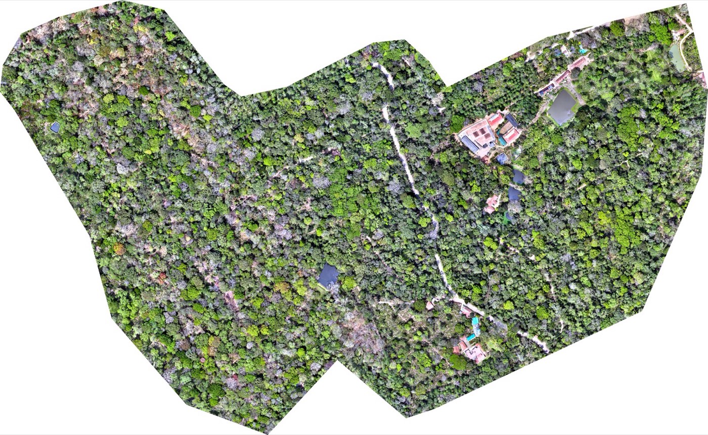
Orthomosaic
RGB aerial map, up to 3 cm/pixel
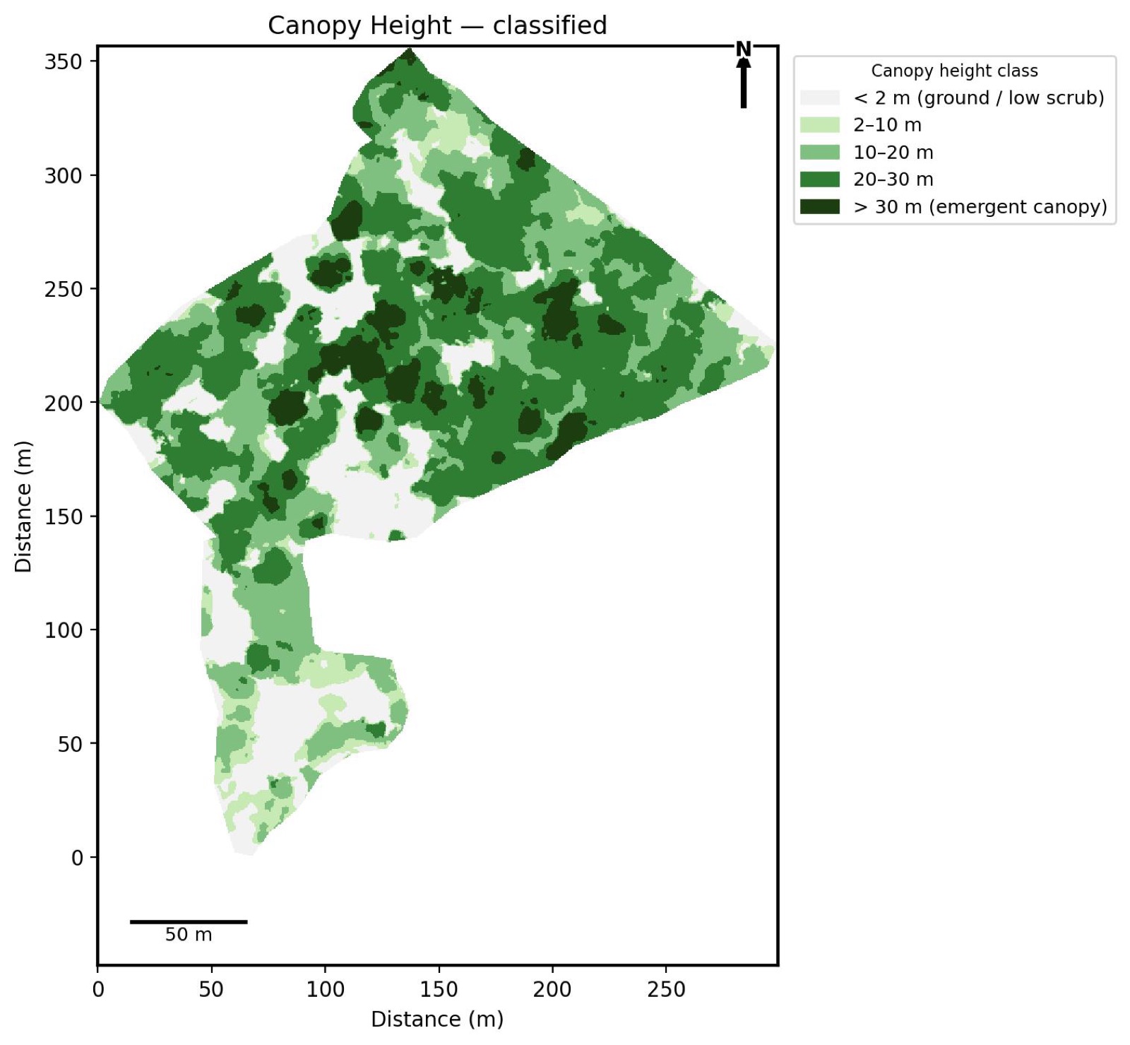
Canopy Height Model
Classified canopy height bands
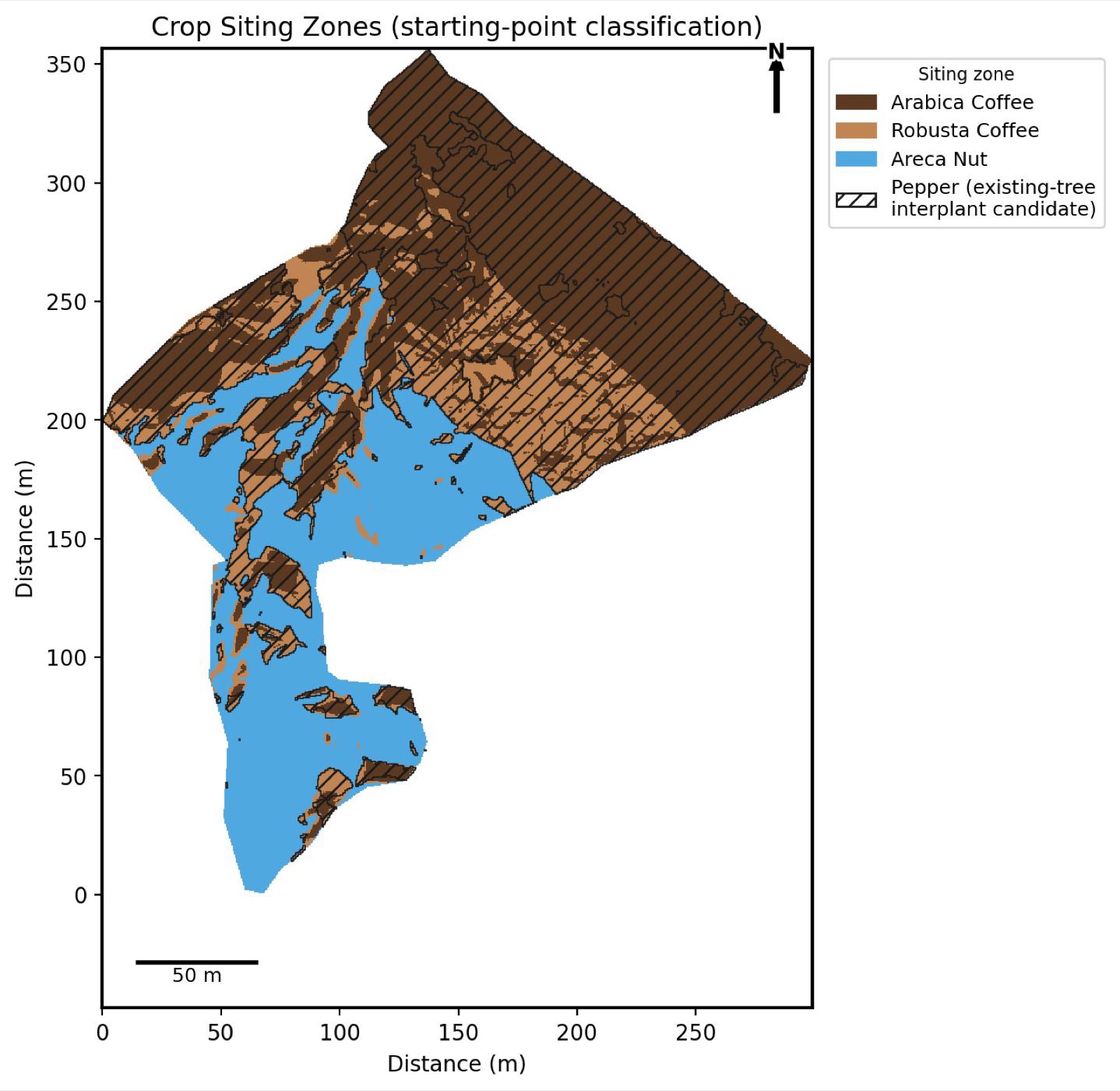
Crop Siting
Zone classification by cultivation fit
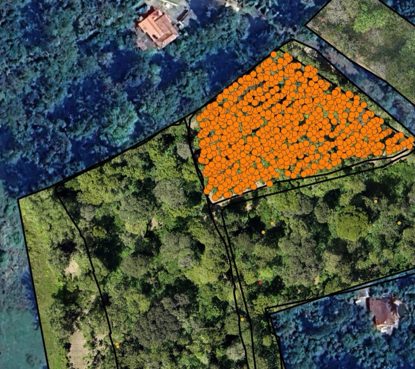
Tree Detection
Individual plant detection & count
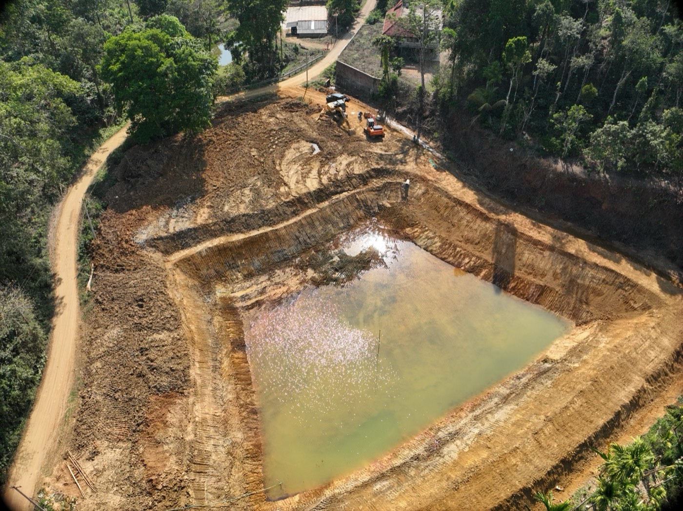
Water Infrastructure
Pond & lake volume surveys
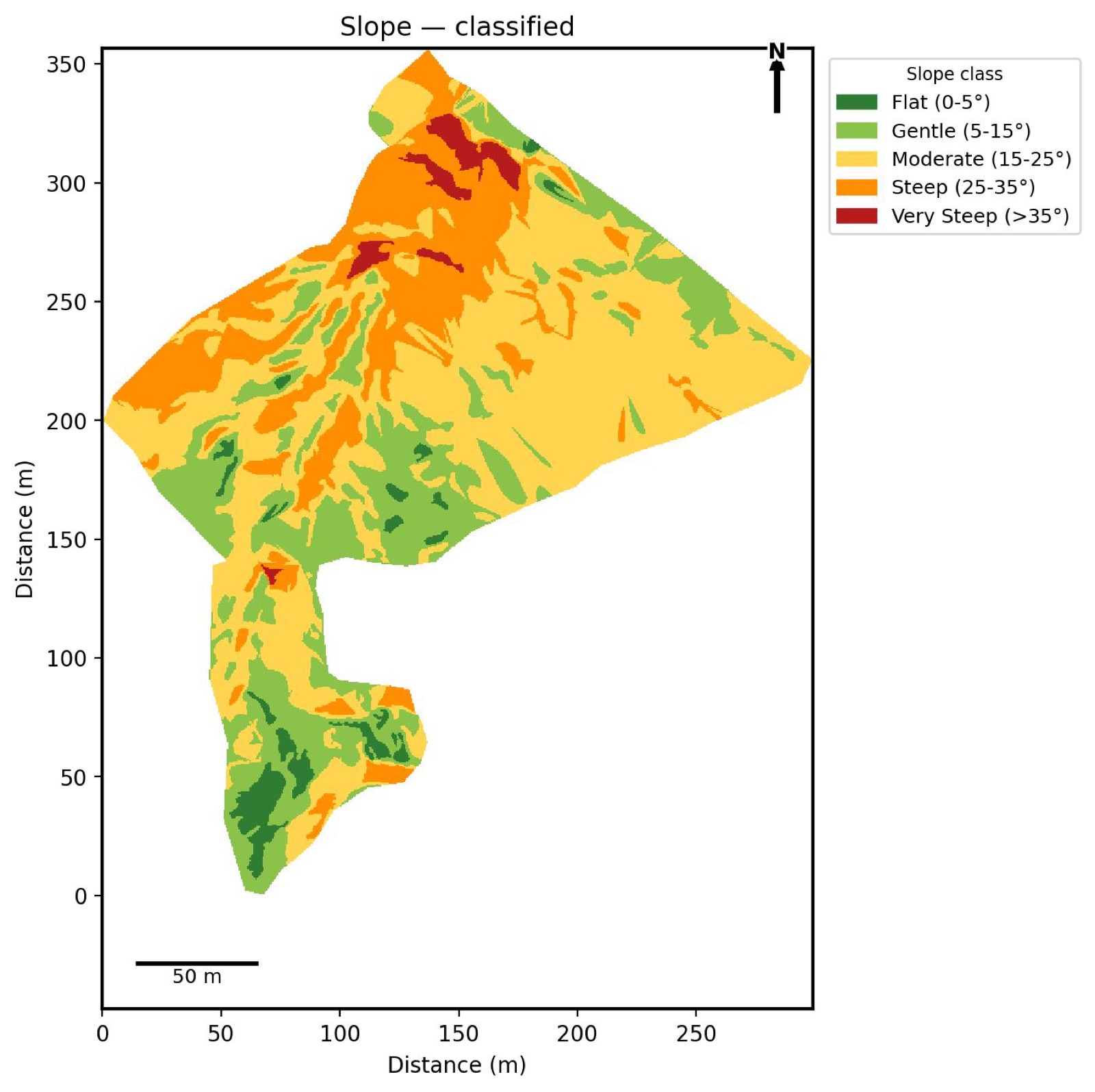
Slope Analysis
Terrain steepness, classified
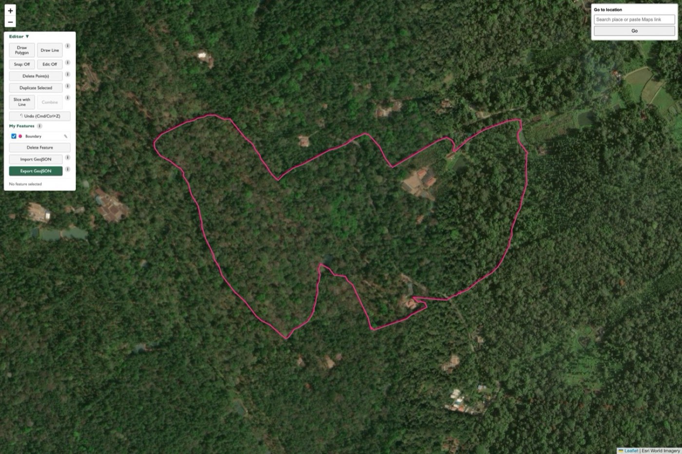
Field Planning
Boundary editor, live in your browser

ThotaTracker
Live estate operations dashboard
Curious how our precision GPS network makes all of this centimetre-accurate? Read how RTK base stations work →
Live now
Drone mapping tools, right in your browser
No QGIS install, no GIS background needed. Draw and edit a site boundary, auto-generate an automated video flight path, and export flight-controller-ready files — all from tools.futurethota.com.
Built from the same field workflow we use on real survey projects, ported to the web so any drone operator can use it without learning GIS.
Boundary Editor
Draw and edit site boundaries in the browser — vertex snapping, undo, GeoJSON import/export.
Automated Flight Paths
Auto-generate a lawnmower-pattern video flight path from any boundary — no manual flight planning.
KMZ Export
Download ready-to-fly .kmz files, ready to load straight onto your flight controller.
Instant Access
No install, no license — just a quick sign-in and you're mapping.
Built for the field
ThotaTracker — your plantation, fully digital
Most plantation operations still run on paper registers, WhatsApp messages, and end-of-season guesswork. ThotaTracker replaces all of that with a single app — built specifically for how estates actually work.
It is a Progressive Web App that installs on any iOS or Android phone like a native app. It works fully offline in areas with no signal, syncs automatically when you reconnect, and mirrors the paper workflows your supervisors already use — so adoption is frictionless.
Already live and in active daily use on a production coffee estate. Every picking session, processing batch, and inventory movement logged digitally — no paper, no gaps.
Now connecting to your drone survey: blocks you draw in the survey dashboard can feed into ThotaTracker to compare yield across the plantation block by block, as long as the harvest is GPS-tracked so each day's picking matches its block. Next, an AI advisor (a separately priced add-on) that answers plain-language questions using your survey's terrain, canopy and water alongside ThotaTracker's yields and costs.
Estate Dashboard

Picking Cost Breakdown

Season & Estate Reports
Real screenshots from the app running on an active coffee estate — not a mockup.
Who We Work With
Built for organisations that need ground truth — not just satellite averages.
Plantation Owners
Coffee, tea, and spice estate managers who want accurate maps, crop health data, and digital records.
Agri-Tech Companies
Startups and firms that need drone data, GIS workflows, or field intelligence integrated into their stack.
Research & NGOs
Academic teams and field programmes requiring geospatial data collection and processing for agricultural studies.
Government & AIC
Agricultural bodies and incubators working on precision farming, crop area estimation, and land monitoring.
Traction
From the field to the incubator — what we have built and where we are going.
Where we're headed
We build the layers that precision agriculture runs on — and open each one up as it matures, as skilled local work or as a product anyone can use.
The ground layer
We help farmers set up their own precision-GPS base stations. Each one earns its host an incentive and gives the surrounding area the centimetre-accurate positioning that survey drones, ground data collection, and future autonomous machines all depend on.
Skilled local work
Training for drone operators and GPS ground-data collectors. As our mapping pipeline becomes a product, operators can take survey and field-tagging work independently — in their own area, at their own pace, alongside other work.
Modular sensors
Field sensors, starting with a rain gauge (a modularly expandable weather and multi-sensor station) — built to be repaired, upgraded over the air, and extended with add-on modules. Designed so the electronics can be reused and the plastics recycled rather than thrown away, and to give growers hyper-local rainfall data far more accurate than distant weather stations.
A shared picture
Over time, drone surveys and a farmer-hosted sensor network build an empirical, farm-level view of each estate's land and its environmental footprint — useful to growers and to the companies that source from them.
Underneath all of it: open, plain-language education, because technology only gets adopted when it is understood.
Sustainability & Carbon
The same field data that helps a grower manage their land is also the raw material for measuring its environmental footprint. We are developing empirical, farm-level methods for carbon measurement — grounded in what is actually observed on the ground rather than generic per-hectare assumptions, and built for the reality that no two estates are managed the same way.
For growers
A clearer picture of the land's carbon and canopy over time, and where practice changes make a measurable difference.
For companies that source from farms
Independent, evidence-based assessment and ongoing tracking of conditions across the farms in a supply base — not self-reported estimates.
This is active research and development. If you are working on plantation sustainability or supply-chain measurement, get in touch.
From the Blog
Field notes on drone mapping, GIS, and agri-tech from South India.
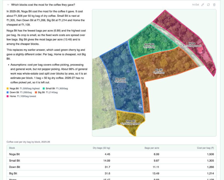
Ask Your Farm: How the AI Reads Drone Data and Ground Records
How the farm dashboard's AI answers questions from a drone survey joined to harvest records: cost per bag by block, where to put a road, which block has the best pepper.
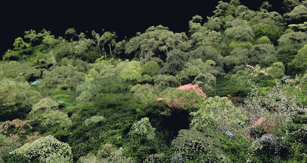
Point Cloud: A True-Colour 3D Digital Twin of Your Estate
The Point Cloud tab of the farm dashboard: millions of measured points in true colour showing tree crowns, canopy layers and buildings, viewed from any angle.
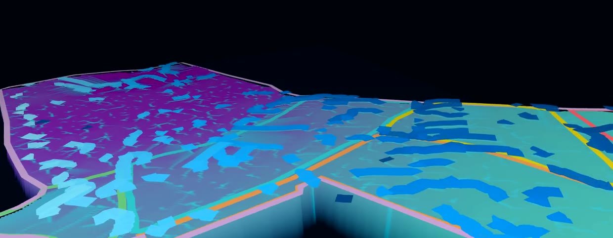
3D Terrain: See How Your Land Behaves, Not Just Where It Is
The 3D Terrain tab of the farm dashboard: a bare-ground model of the estate you can tilt and spin, with rainwater flow and sun-and-shade simulations.
Ready to map your plantation?
Drone surveys, GIS analysis, and plantation intelligence. Get in touch to discuss your project — no obligation.
Get in touch